

{Shikoku Hachijūhachikasho Meguri}
--WALKING--
--HOW FAR TO WALK EACH DAY--
--WALKING--
--HOW FAR TO WALK EACH DAY--
As for total distance, you see a lot of different numbers on the internet. I say the trip is 1,400 km, and got that by adding up the km i walked each day using the distances in the Shikoku Henro: Hitori Aruki Dōgyō Ninin guidebook (see my daily log). But, i walked to the all of the bangai temples as well as the main 88 temples. If you don't visit the bangai temples, the total for your walk will be less than 1,400km, my guess is between 1,100 and 1,200 km.
How long it will take you to walk the entire distance will depend on how far you are willing and able to walk each day. Everyone walks at a different pace, and every one has a different schedule, so telling people how far they should walk each day isn't an easy issue to address.
When i walked the pilgrimage in 1999, i averaged about 25 km/day, with occasional days below 20 km and about once a week going more than 30 km. Actually, my daily distances were widely scattered between 20 km and 30 km. The last 5 km, or so, of every day was almost always dictated by where that nights lodging was. Sometimes i would stop at 19 km because it was that or walk over 30 km. Sometimes it was the opposite and i would walk over 30 km because that is where the next available lodging was. But, as i say, i think that an average of about 25 km/day was what i did.
I took just short of 8 weeks to walk around the island (but again, i visited all of the bangai temples). There are people who walk the pilgrimage in as little as 5 weeks. Very few take longer. It seems to me that most people who only visit the main 88 temples take about 7 weeks. While i took no days off to rest, some do. I never felt that i needed it. A steady 25 km/day was a good relaxing pace and i never felt overwhelmed. Personally, i think that walking the trail in less than 7 weeks is going too fast. I know some of you who read that will disagree, and maybe strongly, but when you walk it that fast, you are missing a lot of what i consider the most interesting part of this trip — the chance to just stop and enjoy the scenery or to visit with people along the side of the road.
Here's what i think most of you should expect when you start your trip:
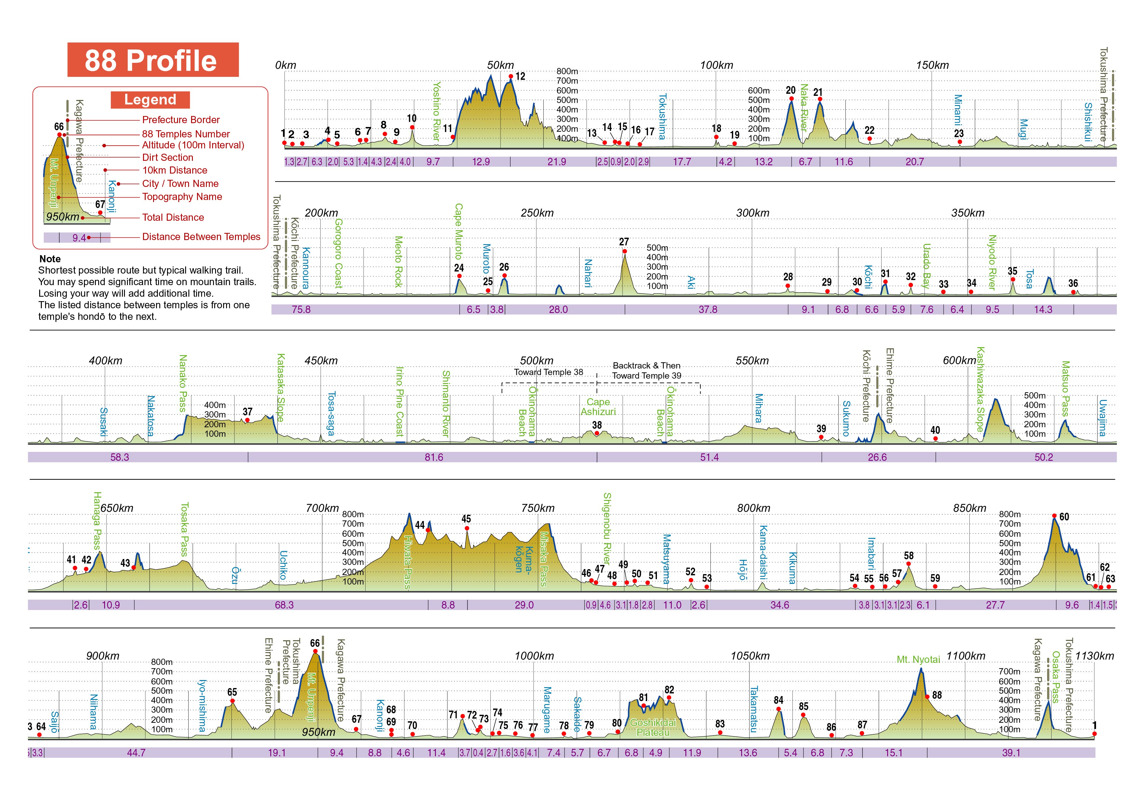
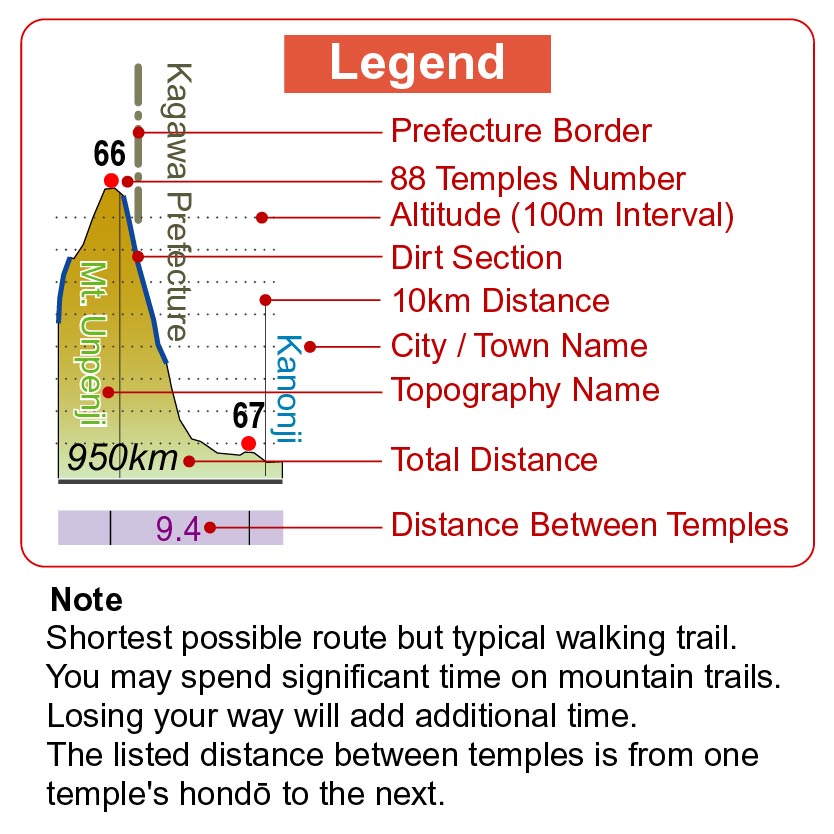
Elevation Profile
| Click image to enlarge, but be warned, two of these file are large. | ||||
 |
 |
 |
||
|
Entire profile, in one long line. (1.5MB) |
Reformatted to make it easier to print. (1.3MB) |
Legend by itself, in case you want to print it separately. (130KB) |
||
(If you want to comment on the profile, or make any suggestions, send me a note at the address on the 'Contact Me' page. Or, if you want to communicate with the editor, you can do so in the Online Forum, in the section set aside for the guidebook.)