

{Shikoku Hachijūhachikasho Meguri}
--PLANNING--
--WHEN SHOULD YOU GO?--
--PLANNING--
--WHEN SHOULD YOU GO?--
 Traditionally, the pilgrimage is walked in either the spring or the fall. While it can be done during the summer, it is considered too hot and humid by all but the bravest, and during the winter it is just too cold to be enjoyable.
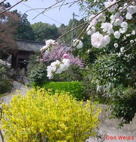
The spring season is usually between mid-March and the end of May with the vast majority of people walking the trail during the months of April and May. It is possible, if you are willing to tolerate the snow on the higher passes, to start as early as the end of February, but it can still be extremely cold in the mountains at that time. You can also stretch the walk out into June but in this part of Japan the rainy season starts around the first or second week of the month.
Summer is not when you should be thinking of walking the henro trail. While the rainy season on Shikoku usually starts in early June, it can start as early as mid- to late-May. Before that rain shouldn't be more than an occasional nuisance. After that it is a daily issue. Having said that, though, it rained hard enough one day early in my '99 pilgrimage that the locals compared it to a typhoon. That was the only time i saw rain that hard, but EVERYTHING in my pack and on my body got wet. If you are thinking of walking in June (which you shouldn't be thinking about), be sure to pack appropriately. By this i mean, no pack by itself (no matter the manufacturer's claim) is water tight.
 The storm i just mentioned went through the pack cover and the backpack. Pack everything in plastic bags or Tupperware-like containers. I now put a large heavy-duty garbage bag in my pack and then pack everything inside that.
While the "rainy season" is typically said to be from mid-June to mid-July, i'd count on seeing rain anytime from around the 4th week of May just to play it safe. If you plan on being on the trail in June plan on walking in daily, sometime very heavy, rain after the first week of the month. Even worse than the rain, in my opinion, is that from early July through late August or early September you can count on hot weather and very high humidity, sometimes unbearably high.
The fall season is generally between mid-September and mid-November and is the second most popular walking season. The closer you try to push this back towards August the hotter it is during the day and the higher the humidity. After the middle of November, you risk the chance, again, of running into freezing temperatures and snow at the higher elevations.
However, not everyone agrees that winters are too cold. As another opinion, i received this note from a woman who has walked the henro trail and used to live in Tokushima.
To give you an idea of the temperatures on the island throughout the year, below is a table with the average, high, and low temperatures (Celcius/Farenheit) in the four largest cities (2006 data). Keep in mind, though, that these temperatures are for coastal towns located at sea level and some/much of your walking will be at much higher elevations.
| °C/°F | Tokushima | Kōchi | ||||||
|---|---|---|---|---|---|---|---|---|
| Date | 3/15 | 5/15 | 9/15 | 11/15 | 3/15 | 5/15 | 9/15 | 11/15 |
| Ave | 6.3/43.3 | 17.1/62.8 | 23.6/74.5 | 13.0/55.4 | 6.9/44.4 | 18.1/64.6 | 23.7/74.7 | 13.9/57.0 |
| High | 11.6/52.9 | 20.7/69.3 | 27.2/81.0 | 16.3/61.3 | 13.6/56.5 | 22.7/72.9 | 29.8/85.6 | 18.0/64.4 |
| Low | -0.2/31.6 | 12.1/53.8 | 19.4/66.9 | 9.8/49.6 | -0.4/31.3 | 11.7/53.1 | 18.5/65.3 | 10.1/50.2 |
| Data from Shikoku Henro Hitori Aruki Dōgyō Ninin by the Henro Michi Hozon Kyōryoku Kai | ||||||||
| °C/°F | Matsuyama | Takamatsu | ||||||
|---|---|---|---|---|---|---|---|---|
| Date | 3/15 | 5/15 | 9/15 | 11/15 | 3/15 | 5/15 | 9/15 | 11/15 |
| Ave | 7.5/45.5 | 16.0/60.8 | 23.0/73.4 | 13.7/56.7 | 6.5/43.7 | 16.3/61.3 | 22.8/73.0 | 13.4/56.1 |
| High | 14.6/58.3 | 19.6/67.3 | 27.3/81.1 | 16.1/61.0 | 13.7/56.7 | 19.3/66.7 | 26.4/79.5 | 16.2/61.2 |
| Low | 0.7/33.3 | 10.7/51.3 | 19.0/50.0 | 9.1/48.4 | -0.5/31.1 | 11.3/52.3 | 18.2/64.8 | 9.8/49.6 |
| Data from Shikoku Henro Hitori Aruki Dōgyō Ninin by the Henro Michi Hozon Kyōryoku Kai | ||||||||