

{Shikoku Hachijūhachikasho Meguri}
--MAPS OF THE PILGRIMAGE--
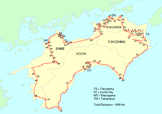
Simple map of the island with temple numbers for the main 88 temples.
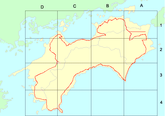
A clickable version of the map at the top. Click in one of the squares to zoom into that area.
--MAPS OF THE PILGRIMAGE--
Simple map of the island with temple numbers for the main 88 temples.
A clickable version of the map at the top. Click in one of the squares to zoom into that area.
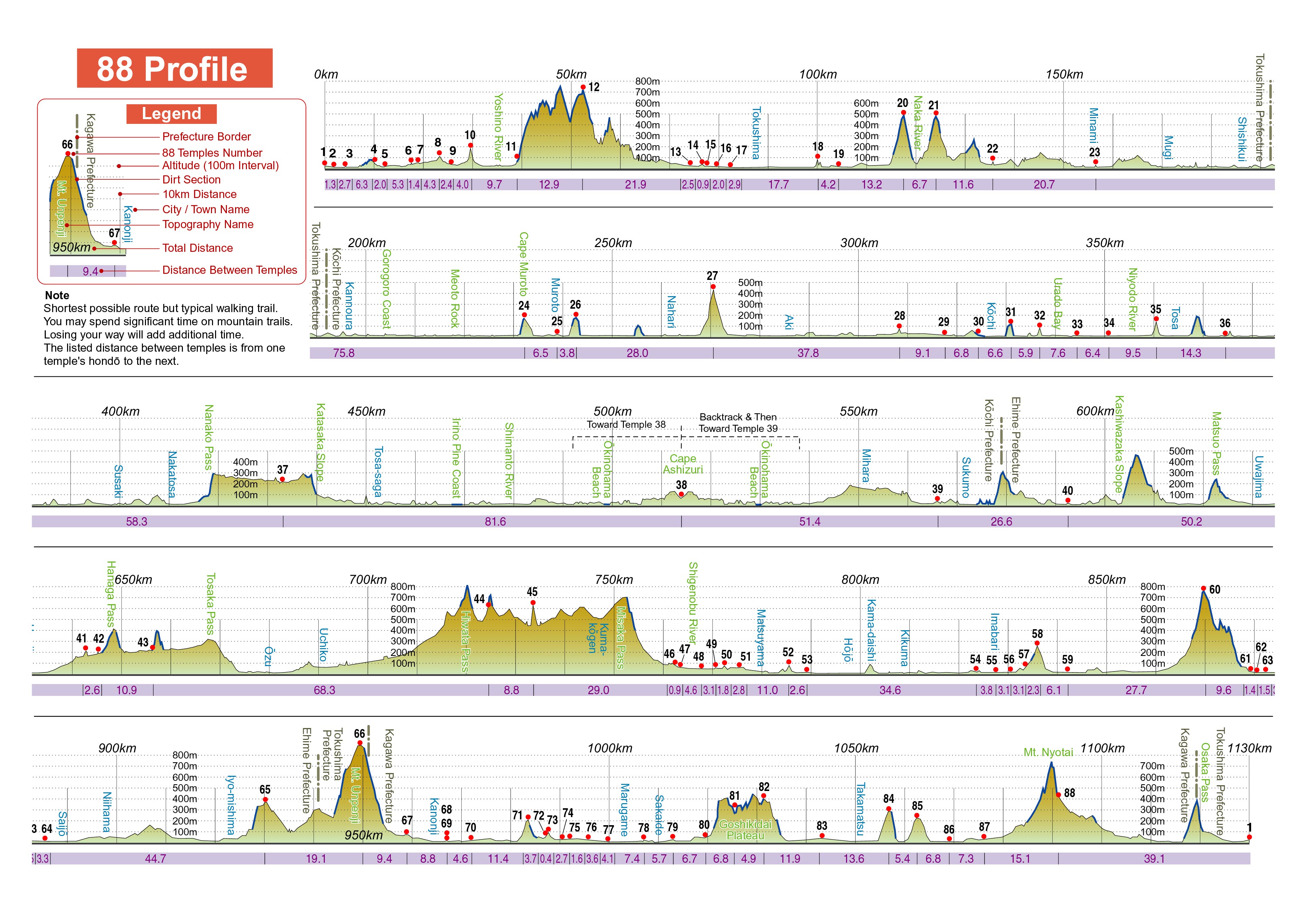
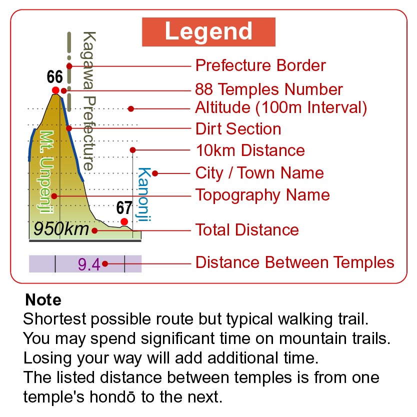
Elevation Profile
| Click image to enlarge, but be warned, two of these file are large. | ||||
 |
 |
 |
||
|
Entire profile, in one long line. (1.5MB) |
Reformatted to make it easier to print. (1.3MB) |
Legend by itself, in case you want to print it separately. (130KB) |
||
(If you want to comment on the profile, or make any suggestions, send me a note at the address on the 'Contact Me' page. Or, if you want to communicate with the editor, you can do so in the Online Forum, in the section set aside for the guidebook.)
Thanks for your efforts, Matsushita-san.
Google Maps
Thanks for your efforts, John.
Wall Poster/Map
While it is a good general overview of the henro trail, it does not provide the detail that is provided in either the English or Japanese guidebooks that you will use to walk the trail. So, while this is nice to give you a large picture overview of what you are getting into, or what you just did, or for your family back home to follow your travels while you walk, this can not replace the maps in the guidebooks.
Other Maps
